The Tahoe Rim Trail is a 165-mile (266 km) long-distance hiking trail that forms a loop around the Lake Tahoe Basin in the Sierra Nevada and Carson ranges of California and Nevada in the United States. The trail ranges in elevation from 6,240 feet (1,900 m) at the outlet of Lake Tahoe to 10,338 feet (3,151 m) at Relay Peak in Nevada. About 50 miles (80 km) of trail above the lake’s west shore are also part of the much longer Pacific Crest Trail. Additionally, 96 Miles of the trail along the east and south sides of the Lake Tahoe basin are designated as a National Recreation Trail.
Before the hike
Hiking the Tahoe Rim Trail and John Muir Trail
During the hike
Day 5: Downhill (mostly) to Watson Lake
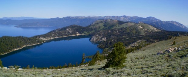
Day 8: Into Desolation Wilderness
Day 10: Goodbye Pacific Crest Trail
Day 11: Tahoe Rim Trail – done!
After the trail
