Day 21: On top of Mt Whitney

0.4m north of Guitar Lake to Whitney Portal

Mileage: 16.8 miles, total 210.4 miles

Max elevation: 14,505 feet (Mt Whitney summit)

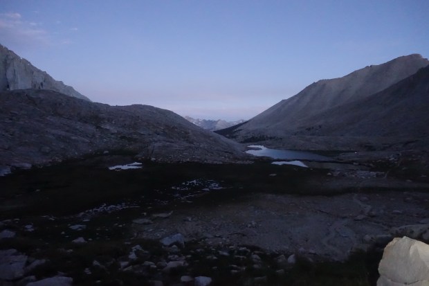
I woke at 3.15 AM to the sight of headlamps snaking their way up the mountain. It reminded me of Kilimanjaro and, whilst I briefly wanted to charge up there after them, I was happy with our decision as otherwise we would have had to rise at midnight. This way we got some sleep at least.

The trail initially climbed up via some steep switchbacks. It was nice climbing by the light of our headlamps and that of the moon but the day soon brightened enough that we could walk by the oncoming dawn.

The switchbacks were nice and long and easy but we kept our pace as slow as possible given the altitude we were climbing to. We came across a group who said they had bumped into a pair of hikers earlier who had to abandon their attempt on Whitney due to altitude sickness. In addition, we came across blood which had dried on the trail apparently from someone’s nose bleed, another sign of altitude sickness.

Continue reading

Day 20: Guitar Lake

Tyndall Creek to 0.4 miles up from Guitar Lake

Mileage: 11.5 miles, total 206.3 miles

Campsite elevation: 11,658 feet

Last night ended up being quite cold at Tyndall Creek. It was the first night on the trail which I have had the sleeping bag zipped right up and wore long clothes to sleep in. It didn’t warm up until the sun rose above the mountains.

Today was basically a day to get us set up for the ascent of Mt Whitney tomorrow. Although it could technically be done in a day, there is too much of a risk of dangerous thunderstorms occurring on the summit in late afternoon. Whilst the forecast for us was good, we thought we would go the safety first route and camp at Guitar Lake before our summit attempt in the morning.

Continue reading

Day 19: Forester Pass

Vidette Meadow to Tyndall Creek

Mileage: 12.3 miles, total 194.8 miles

Max elevation: 13,124 feet (Forester Pass)

Campsite elevation: 11,041 feet

Today was a day we were both excited about and a little nervous as we would be climbing to the highest point on the Pacific Crest Trail being Forester Pass at 13,124 ft. Forester is a little notorious for both the steep, precipitous drop offs on it southern side as well as the ice chute where hikers cross a 50 degree snow field with a drop of close to 200 ft.

We started the day approximately 7 miles from the top of Forester so began our climb slowly as we gained elevation. When we climbed Kilimanjaro in 2012, the guides would insist on a slow pace (pole pole in swahili meaning slowly slowly) and on drinking lots of water. We tried to take this into account on the ascent taking it nice and easy.

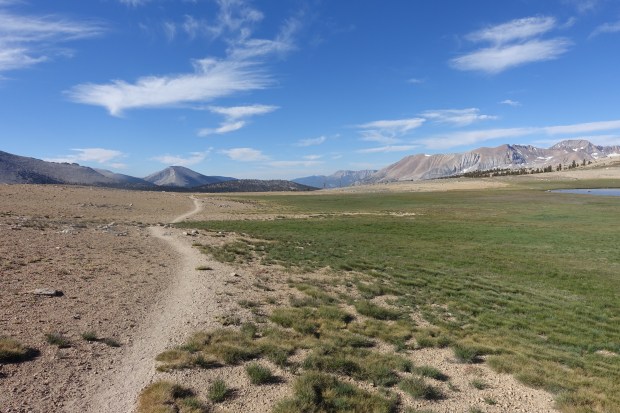
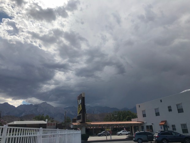
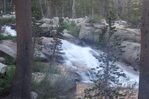
The trail continued through the pine forest for a while before reaching tree line. There were some beautiful views as we climbed up.

Continue reading

Day 18: Back over Kearsarge

Onion Valley Trailhead to Vidette Meadow

Mileage: 9.5 miles, total 182.5 miles

Campsite elevation: 9,927 feet

We had a busy day today getting our final bits of packing done as we were being picked up at 9 AM. After breakfast and checking out, we were picked up by SherpaMax which is a service which ferries hikers between towns and the various trailheads.

From Lone Pine, it is a 40 mile drive north to a small town called Independence, so named because it was founded on Independence Day. Like many small towns, it has an impressive courthouse whose grandeur is completely out of place with the smallness of the town.

Continue reading

Back on the John Muir Trail

A few years ago, I hiked the John Muir Trail from Happy Isles in Yosemite to Kearsarge Pass, a distance of around 180 miles. We had some weather which came through, including snow which made the passes a little sketchy. We decided to come off the trail at Kearsarge with the intention of returning at a future date. With the completion of the TRT, that time is now.

Tomorrow morning, we will leave Lone Pine and head up Kearsarge to recommence our JMT hike. The weather forecast is looking good with only limited chances of thunderstorms. There were some nasty looking clouds over Mt Whitney this afternoon but we understand it will be clear the next few days so we have a good weather window.

Continue reading

Heading to Lone Pine

After finishing the trail yesterday, we headed down to Lone Pine to start our hike of the John Muir Trail in a few days. The closest town we could find on the drive from Tahoe was Bridgeport which was an hour and a half south of Kingsbury.

We arrived at the motel at around 10pm last night after the drive. The motel was basic but clean and, after a few Facetime calls to our wives and family, it was time to grab some needed sleep.

The next morning, we headed down to the local bar for breakfast. It was one of those places where there are a couple of guys shooting pool in the corner and people look up when you enter. The waitresses were friendly enough and we had breakfast and coffee whilst watching the World Cup.

Continue reading

Two weeks to Lake Tahoe

In a few weeks, I’ll be heading to California from Australia to do a thru-hike of the Tahoe Rim Trail. As well as the TRT, I’ll also be hiking the John Muir Trail from Kearsarge Pass through to Mt Whitney.

xme4kv9gwcsbbjnip5tz

Lake Tahoe along the TRT

The hike has come around very quickly and I’m looking forward to seeing the Sierras again. There has been more snow this time compared to my last hike in 2015 where we saw virtually no snow for the entire hike.

The 2018 snow season has been interesting. March saw a lot of snow hit the Sierras/Lake Tahoe area which means that we will almost certainly see a reasonable amount of snow on the passes. As I am not that experienced in snow travel (read: not experienced at all), it is going to make for an interesting time.

The Tahoe Rim Trail Association (who I have to say have been fantastic with trail info) currently have the following on their website:

March storms dropped a lot of snow in Tahoe and you can still expect to find snow and ice on much of the trail at high elevations and on north facing slopes. Stream crossings and creeks are flowing above average so use caution at water crossings. Thunderstorms and snowstorms are possible any time.

Continue reading

Hiking the Tahoe Rim Trail and John Muir Trail

In June/July this year, I will be returning to the US to hike the Tahoe Rim Trail. As well as this hike, I will also be completing the final stage of the John Muir Trail from Kearsarge through to Whitney which was caught short by snow in 2015.

The TRT has some incredible scenery which is very similar in some respects to parts of the JMT which I hiked in 2015. The combination of the beautiful trees and granite rocks and the lake itself should make for a stunning combination. It is also a logistically easy trail being a loop which makes it simpler in many respects.

Tahoe_Rim_Trail_SL

Continue reading

Heading back to LA

Our biggest challenge was getting back to LA from Independence. The bus only ran every three days and we would be stuck in Independence for several days if we waited for public transport. There was a bus up to Mammoth but that took us even further away from where we wanted to go.

We asked around the day before at the Post Office and was told there was a guy called Kurt who might be able to take us to LA. We gave him a call and he was willing to take us there for $200. Independence is pretty small and we were desperate to get back to LA so we took it.

The next morning Kurt rocked up in his pickup truck. It was tiny and I was sandwiched between Kurt and Ben and straddling the gear box so it was a pretty uncomfortable ride. Kurt offered to take us all the way but instead we asked him to drop us off in Lancaster which then meant a train ride to LA and a shorter and cheaper ride with Kurt.

IMG_1488

Continue reading