7.6 miles/12.2 km
Total miles: 204 miles/329 km
Today marked the eastward transition of the Pennine Way from Greenhead before it begins its push to the border. We deliberately made today a shorter day at only 12km to give us a more manageable day tomorrow as we head into Bellingham, the last town of any size before Scotland.
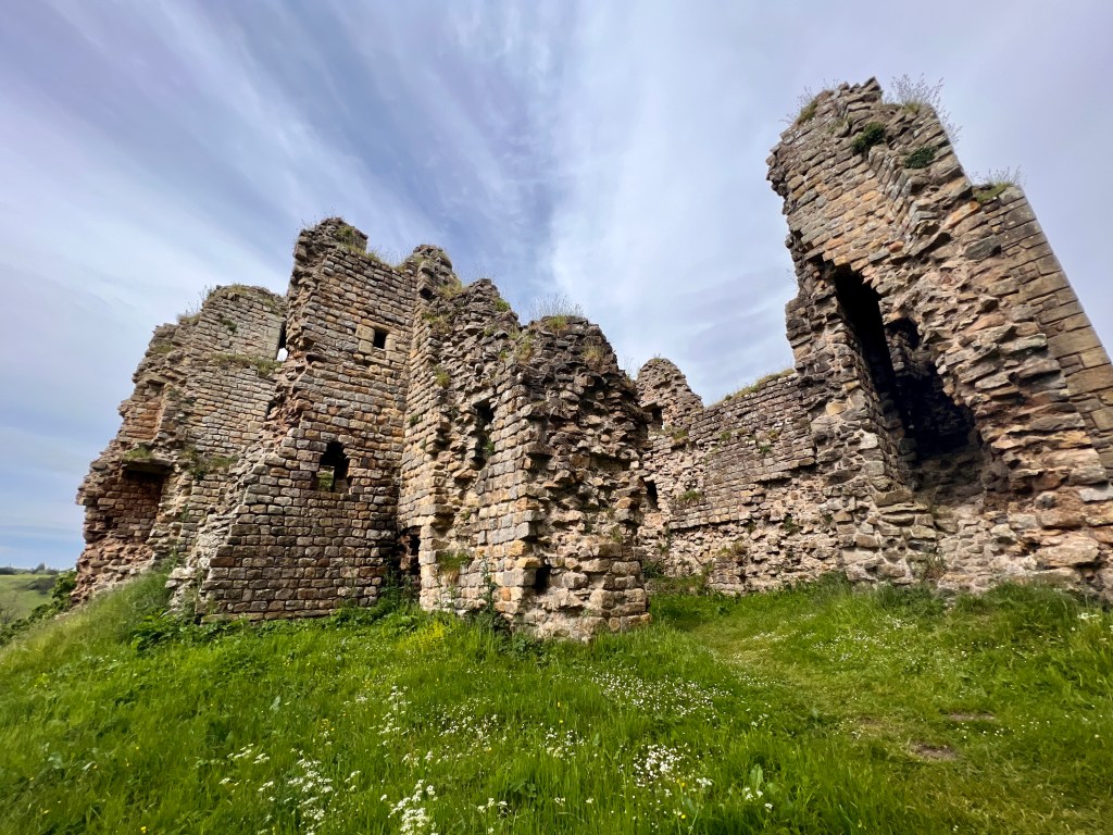
It was nice to have such a short day today so we made the most of it so only leaving Greenhead at 10 AM. The trail almost immediately came upon Thirlwall Castle just outside town. Thirlwall means ‘gap in the wall’ in old English and refers to a break in Hadrian’s wall. The castle was built with stone from the wall and the nearby Roman fort of Carvoran.
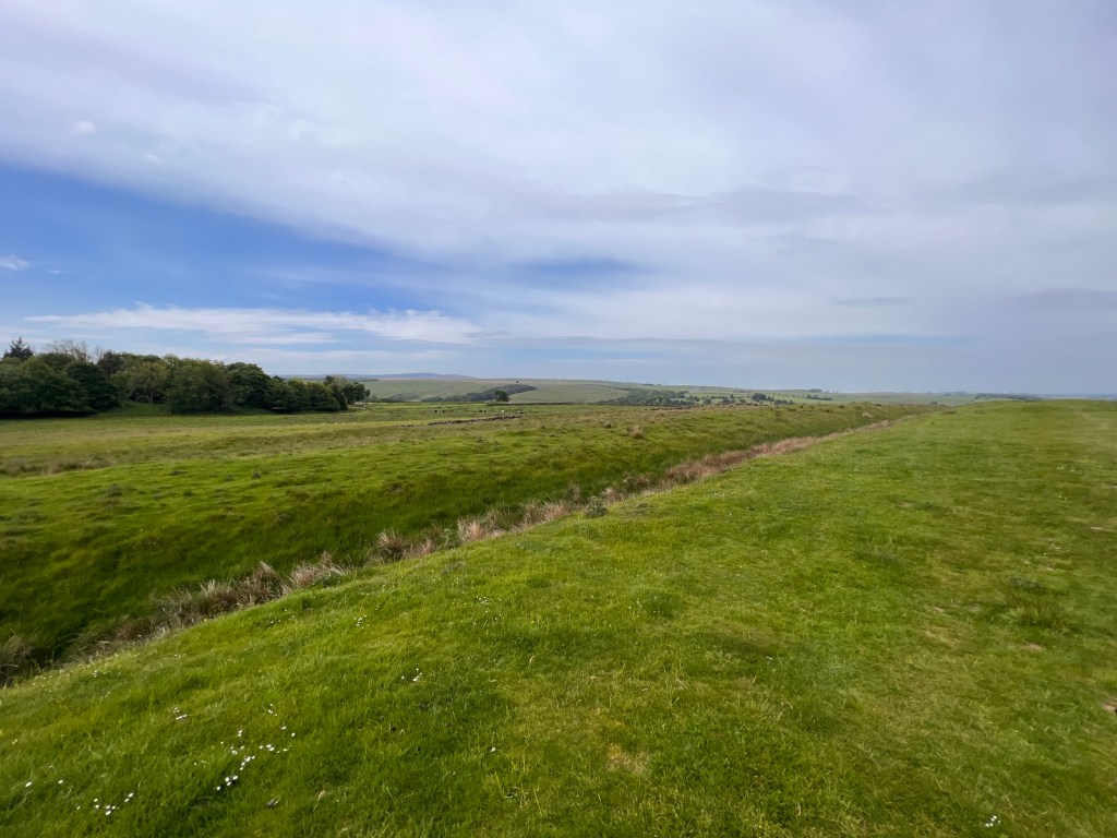
From here, the trail followed some open pasture next to a wide, grassy ditch beside a wall. This appeared to be the remains of Milecastle 48 which the Romans built along the wall. The Way then entered Northumberland National Park, the most sparsely populated one in England. We then finally got our first view of Hadrian’s Wall.
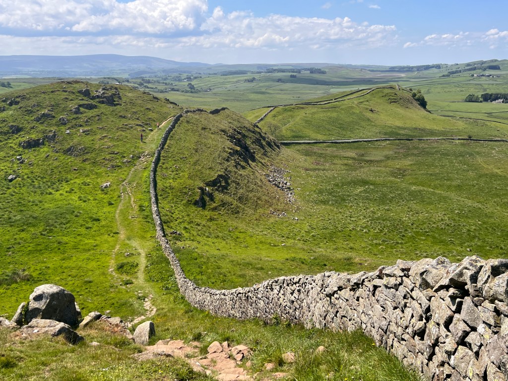
The Wall is really impressive when you first see it and 2022 is the 1900th anniversary of its construction. The fact it has lasted such an incredibly long time demonstrates it was a masterpiece of Roman engineering. It stretches for 80 Roman miles (73 statute miles) across England from the Solway Firth in the west to Wallsend in the east. The Wall was commissioned in AD122 by the Emperor Hadrian and substantially complete by AD130. Its primary purpose was to protect the northern regions from raiding and border incursions by the Picts and it represented the northern limit of the Roman empire.
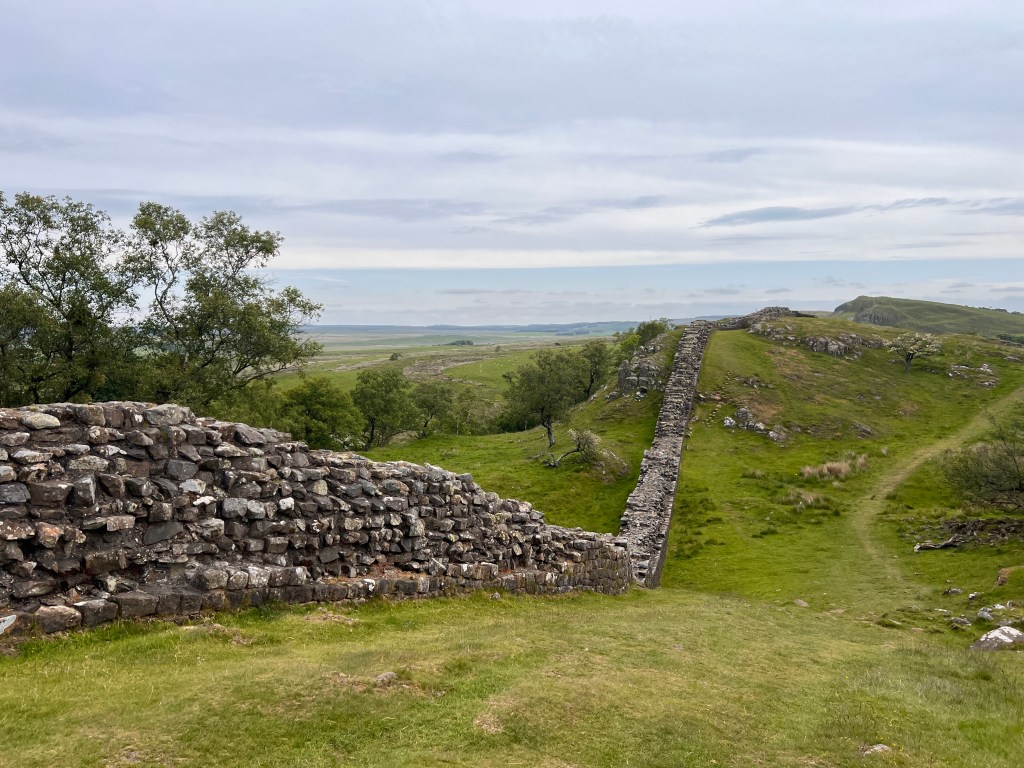
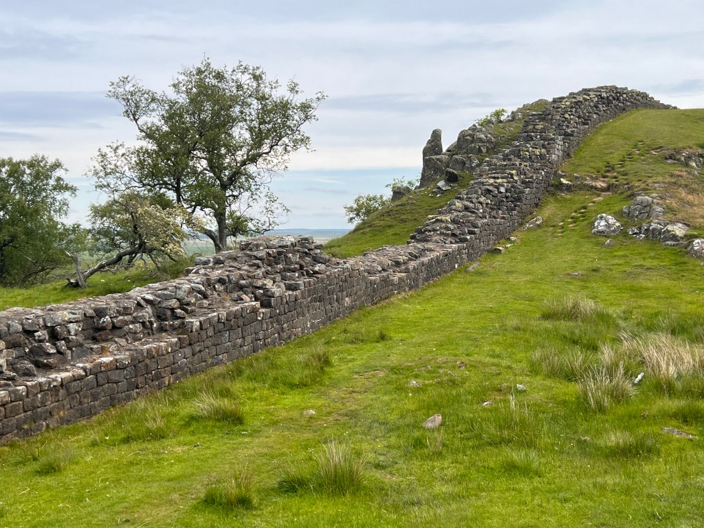
The trail was full of ups and downs as it followed Whin Sill. This is a region of dolerite formed from magma coming to the surface and then hardening. When the surrounding softer rocks eroded away over time, the Sill was left exposed and formed an ideal strategic location for the Romans to build the wall with natural defences supplementing the wall combined with extensive views open to the north.
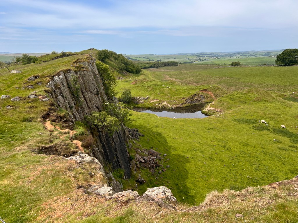

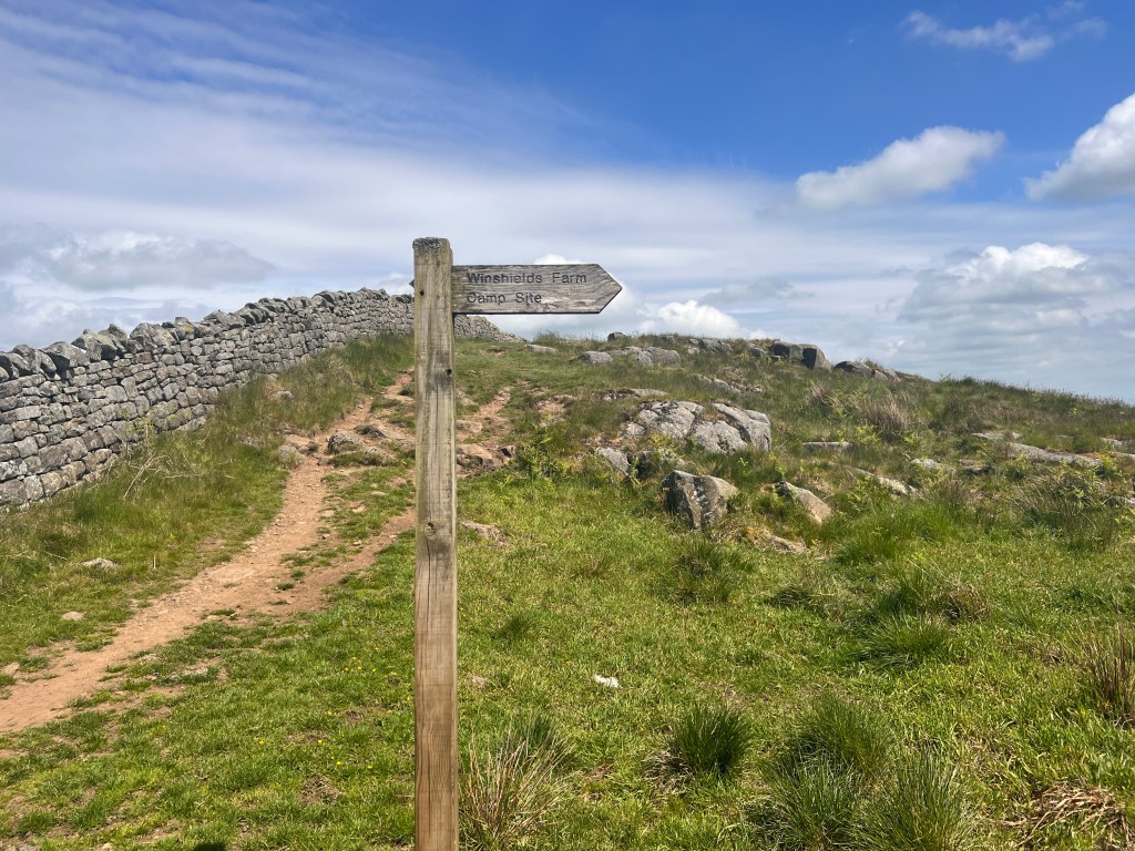
We passed a few remains including Milecastle 42 along the way and eventually reached Winshields Crag which is the highest point on Whin Sill. From here, we descended a short track down to Winshields Farm and our campsite for the night.
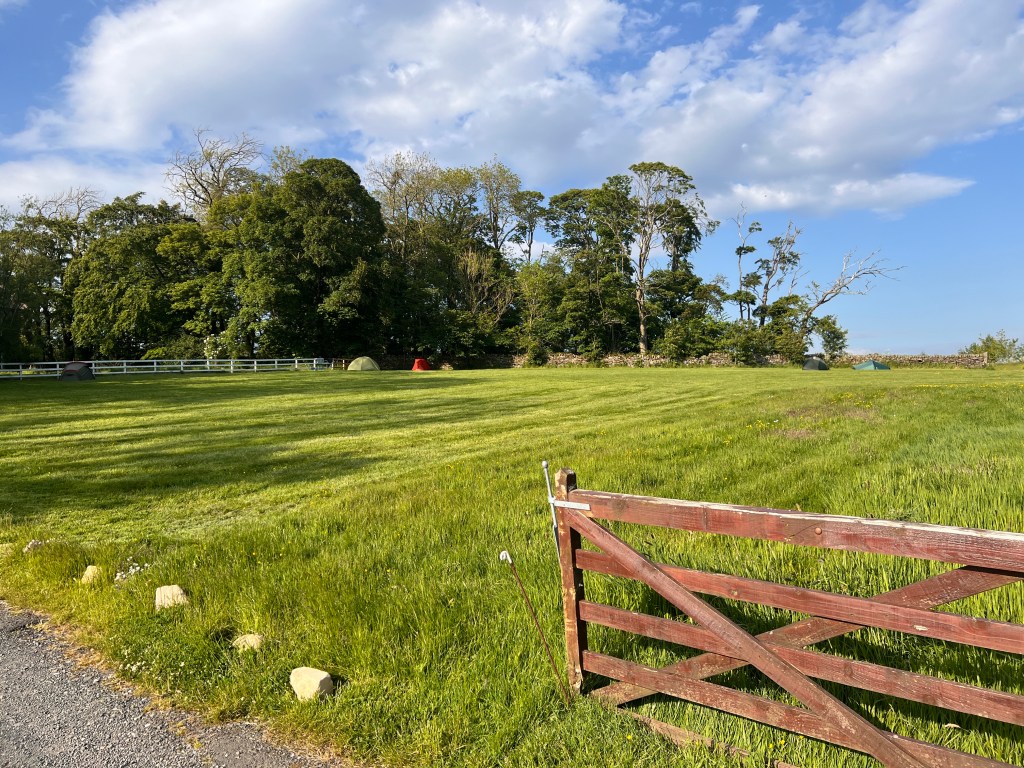
Once set up for the evening, we walked 600 metres up the road from out campsite at Once Brewed to the Sill Visitors Centre at Twice Brewed. This gave a really fascinating amount of information all about the Sill, the Wall and the natural environment of the area.


After that, it was a quick meal at the pub and then back to the campsite. Rain is forecast overnight so hopefully it is not too heavy. Tomorrow, we restart our northern route to the border and Bellingham.
