Vidette Meadow to Tyndall Creek
Mileage: 12.3 miles, total 194.8 miles
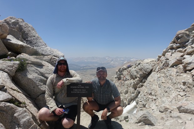
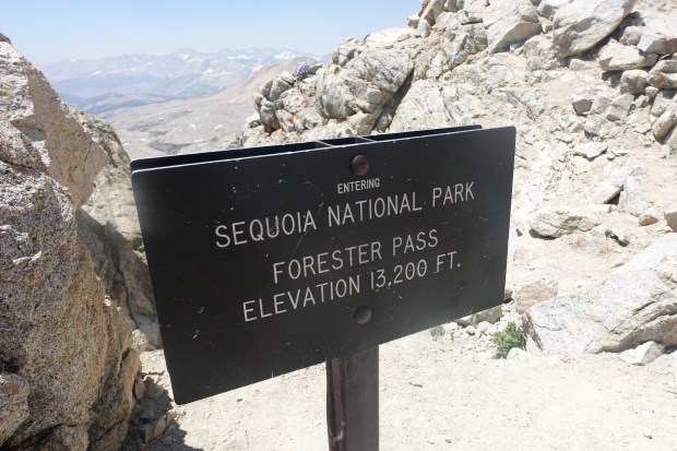
Max elevation: 13,124 feet (Forester Pass)
Campsite elevation: 11,041 feet
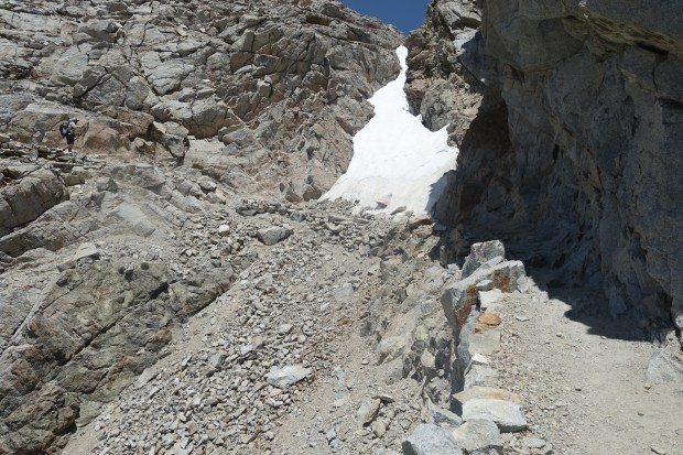
Today was a day we were both excited about and a little nervous as we would be climbing to the highest point on the Pacific Crest Trail being Forester Pass at 13,124 ft. Forester is a little notorious for both the steep, precipitous drop offs on it southern side as well as the ice chute where hikers cross a 50 degree snow field with a drop of close to 200 ft.
We started the day approximately 7 miles from the top of Forester so began our climb slowly as we gained elevation. When we climbed Kilimanjaro in 2012, the guides would insist on a slow pace (pole pole in swahili meaning slowly slowly) and on drinking lots of water. We tried to take this into account on the ascent taking it nice and easy.
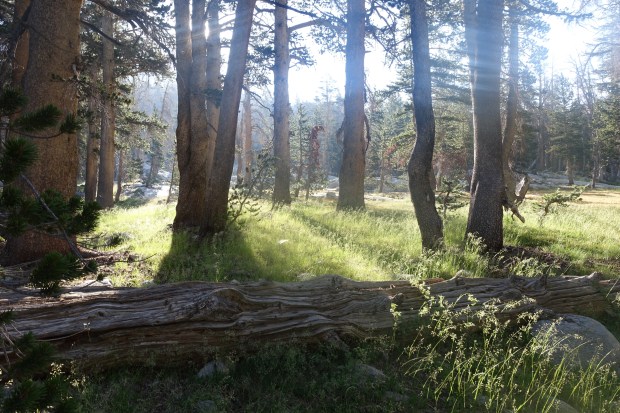
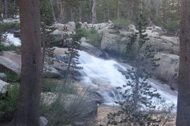 The trail continued through the pine forest for a while before reaching tree line. There were some beautiful views as we climbed up.
The altitude definitely slows you down and you just can’t keep the same pace up as at sea level. We’d stop every now and then for a breather to catch our breath and admire the views.
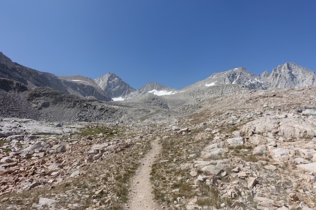
Eventually, we reached the upper part of Bubbs Creek and we entered into the alpine zone. The thing with Forester is that you can see it long before you reach it so the climb seems to take a long time. We stuck to a break every hour so we could keep up the nuitrition and the hydration.
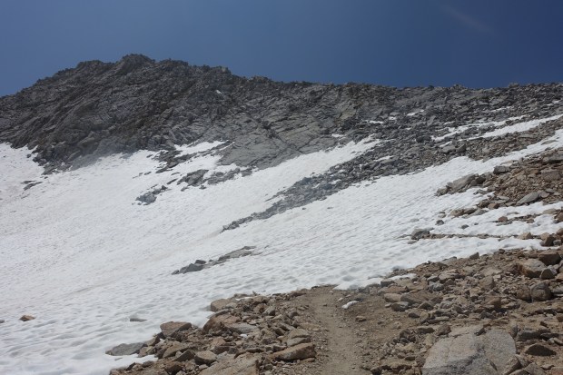
The trail continued to climb upwards and before long we were above 12,500 ft and starting to encounter isolated snow fields. These were fairly easy to deal with at first but later the trail would completely disappear under snow.
The usual strategy is to follow others footsteps when you get to significant snow. At one point we did this, the other end of the snow field had an almost vertical six foot drop back onto the trail. I climbed down without pack or trekking poles which Ben then passed down to me at the bottom whilst I grabbed his gear so he could descend.

Near the top, whole switchbacks would disappear under snow forcing us to climb upwards from one switchback to another which proved exhausting at 13,000 feet with a full pack on.
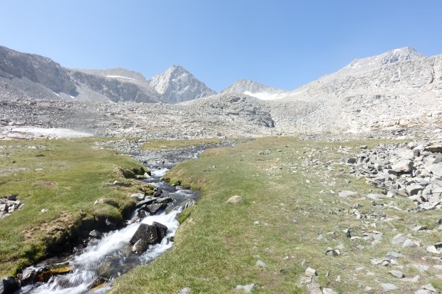
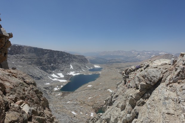
Eventually we reached the top. The view from the top of Forester Pass is stunning, both back the way we came and also south towards the Palisade Lakes and Tyndall Creek.
We stayed for a half hour or so chatting to the other people who reached the top. It seemed the summit of the pass was so difficult to reach that no-one was un a particular hurry to leave.
But leave we did down to the notorious ice chute. To our great surprise it was completely snow free meaning there was no sketchy snow traverse to do and we could walk straight across.
The rest of the descent was fairly straightforward and before long we had passed the Palisade Lakes and we were below tree line. When we reached Tyndall Creek, we had quite a sketchy river crossing. Fortunately another group had just crossed and were able to let us know a good point downstream. It was still sketchy however and was at the limit of where wading would have been more appropriate. It took some skill to safely get across but before long we were on our way on the other side.
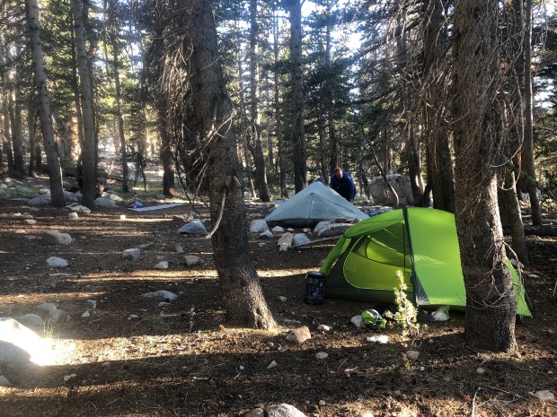
A half hour later we reached our campsite for the day fairly early so were able to relax before dinner. Tomorrow we have a fairly easy day to Guitar Lake which will set us up nicely for our summit attempt on Mt Whitney the following day.

Well done Marcus and Ben to reach the Forrester Peak at 13200 feet! So very proud of you! Clearly God was with you every step of your amazjng journey! Take care and enjoy your remaining California days! Ellen and Henk.
LikeLike
Thanks Ellen!
LikeLike