Around one hour’s drive north of Perth, Walyunga offers some great hiking around the Avon River. The Avon River goes on from here to become the Swan River which flows through Perth and then on into the Indian Ocean.
The Department of Parks and Wildlife describe the park as follows:
“Walyunga National Park covers 1,800 hectares of the Darling Range, tucked behind the Darling Scarp, covering both sides of a steep valley. Just to the east of the park, in the picturesque Avon Valley, the Avon River joins the Brockman River to form the Swan River which passes through the tree-lined valley”.
“Walyunga contains one of the largest known Aboriginal campsites around Perth and was still in use by the Nyoongar people late last century. The area has been used as a meeting place for more than 6000 years.Walyunga is an Aboriginal name, but its meaning is uncertain. It could be a term that, roughly translated, means ‘happy place’. Local Nyoongar people believe the Swan River was carved by the Waugal, and greet the Dreamtime serpent here by rubbing sand on their bodies and throwing it in the water”.
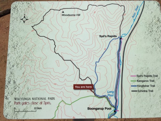
Walyunga is unfortunately only open from 8 AM to 5 PM but camping can be done overnight by arrangement with the Ranger. The are varying walks but the one detailed here is known as the Echidna Trail, an 11km hike out of the Avon Valley and back down to the river.
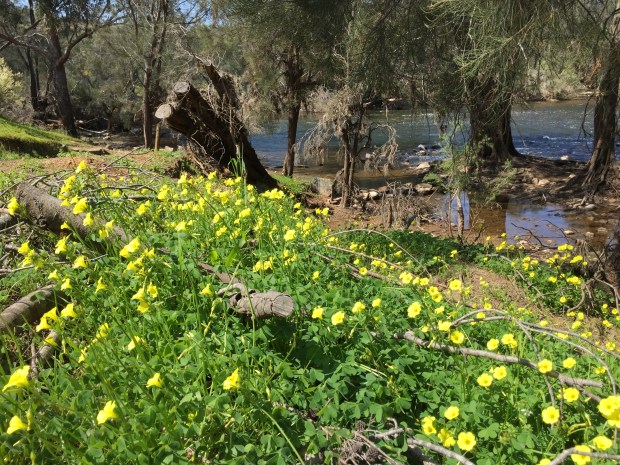
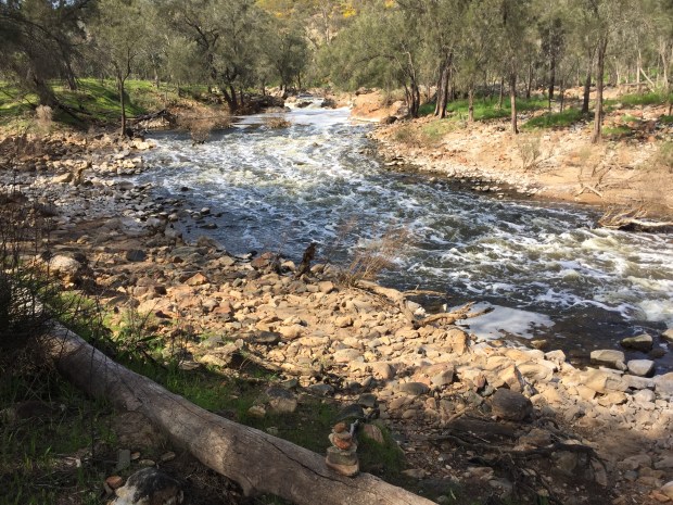
The walk starts with a gentle walk along the Avon itself. With it being mid-September, the Avon was still flowing strongly through the rapids. There were plenty of people in Kayaks braving the rapids. Although only at the beginning of Spring here in Western Australia, it was quite warm being around 25 degrees C with the sun coming out a bright blue sky,

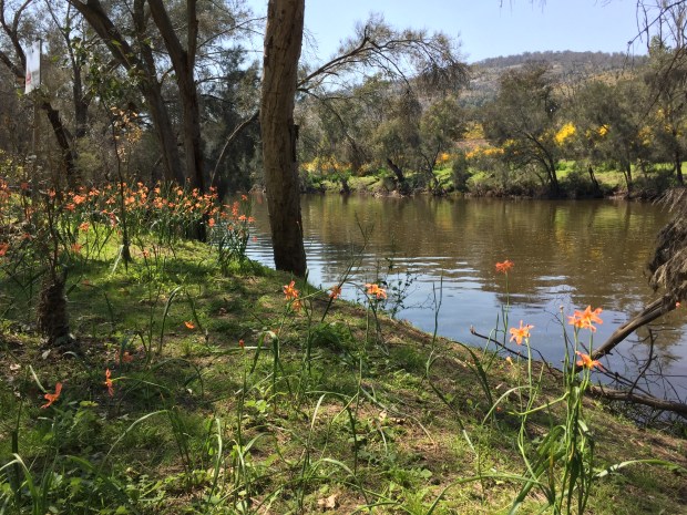
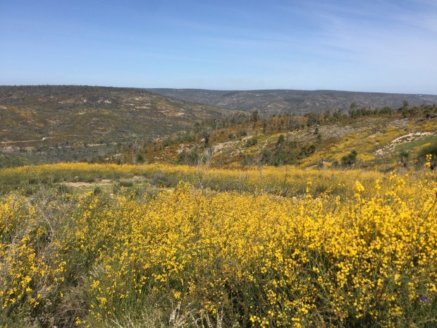
Being Spring, it is wildflower season here and the banks of the Avon were complete with lots of wildflowers. This is probably one of the nicest times to hike in this part of WA with everything being green before the summer heat comes along and everything dries up.
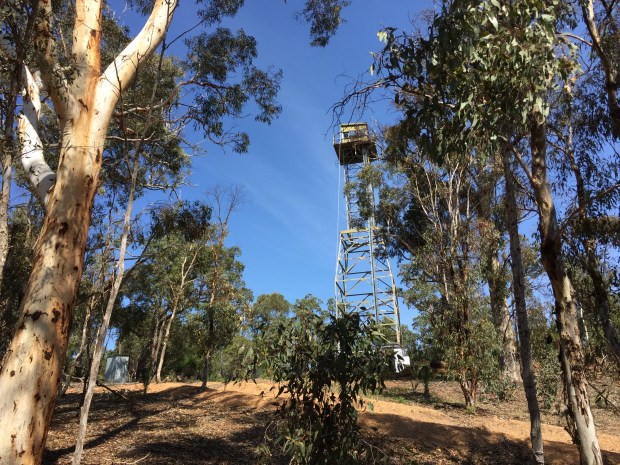
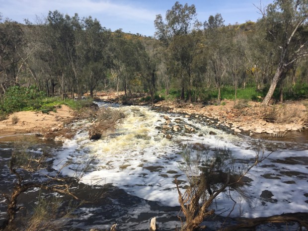
The walk is designed to be walked counterclockwise and is signposted that way but, feeling a little rebellious today, I walked it clockwise. The path leaves the Avon at Syd’s Rapids, a popular spot for kayakers, and then climbs steeply out the valley to Woodsome Hill. The climb is a little unrelenting in the heat but offers some great views back along the coastal plain to Perth in the distance around 30 km SE. Woodsome Hill itself has a fire tower there and marks the end of the climb up from the Avon.
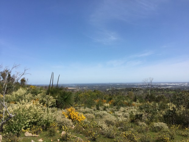
From the top of Woodsome Hill, the trail briefly crosses a saddle which gives extensive views across the Avon Valley. There was a nice breeze blowing across today which took the edge off the heat a little bit. Lots of wildflowers also made for some nice views back across the valley.
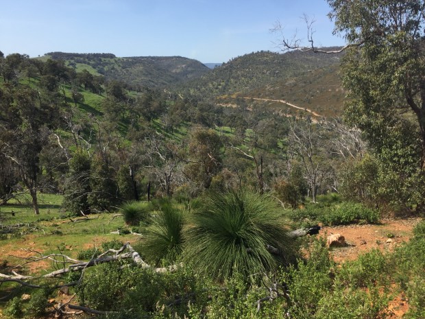
The trail continues south until it is time to descend back down into the Avon Valley again. The trail provides some nice views as it descends back down at times precipitously. This is probably the steepest part of the trail which is one reason to walk it clockwise rather than counterclockwise. The downside of that direction is the views to Perth on the other side of Woodsome Hill are behind you which is probably the main reason the trail was designed to be walked in that direction.
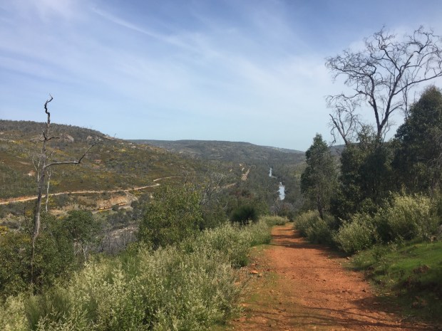
The Avon Valley is then reached at the bottom of the steep descent at Syd’s Rapids which was in full flow. Not a location you would want to try and ford the river to the other bank!
The trail then finishes with a pleasant walk along the banks of the Avon which makes a nice change from the steep hill climbs out of the valley. 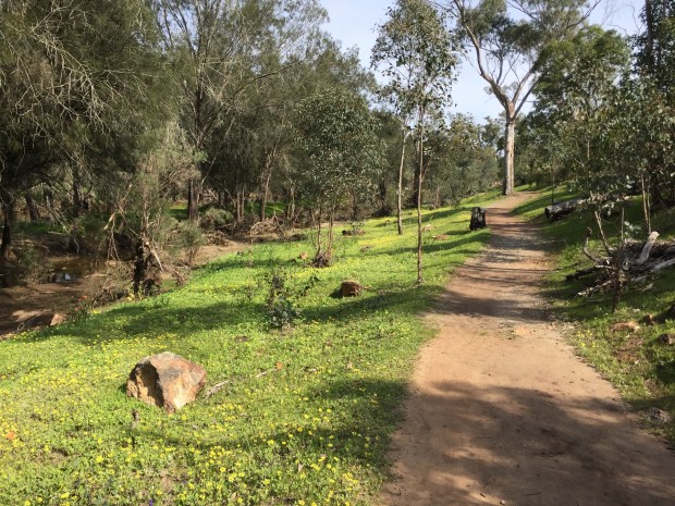
This hike is short enough to only require 2 to 2.5 hours or perhaps longer depending on how leisurely you’d like to take it. Whilst it is popular with people for the view of the Avon, there is quieter walking once you leave the crowds behind on the climb out of the valley. It is one of the best short hikes within a National Park in the Perth region.
