Heading back to LA

Our biggest challenge was getting back to LA from Independence. The bus only ran every three days and we would be stuck in Independence for several days if we waited for public transport. There was a bus up to Mammoth but that took us even further away from where we wanted to go.

We asked around the day before at the Post Office and was told there was a guy called Kurt who might be able to take us to LA. We gave him a call and he was willing to take us there for $200. Independence is pretty small and we were desperate to get back to LA so we took it.

The next morning Kurt rocked up in his pickup truck. It was tiny and I was sandwiched between Kurt and Ben and straddling the gear box so it was a pretty uncomfortable ride. Kurt offered to take us all the way but instead we asked him to drop us off in Lancaster which then meant a train ride to LA and a shorter and cheaper ride with Kurt.

IMG_1488

Continue reading

Day 17: Over Kearsarge Pass

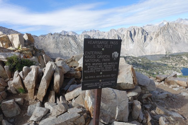
Bullfrog Lake over Kearsarge Pass to Onion Valley

Mileage: 6.7 miles (10.8 km), total 185.2 miles (308.9 km)

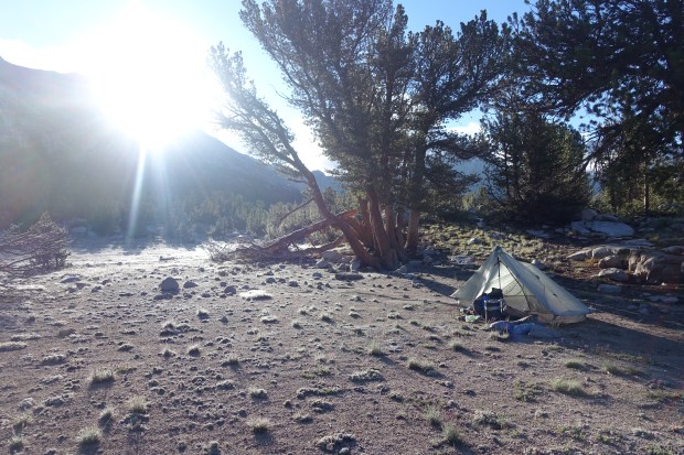
Last night was absolutely freezing and we knew we probably should have chosen a campsite a little higher and out of the cold air. It was very cold the previous night and my 20 degree bag was doing nothing on the cold. I had all my clothes on, insulation layers and rain gear on in the sleeping bag and it only just kept the cold at bay. Ben was cold in his 30 degree bag but made it through the night with all his clothing to keep him warm.

DSC01525

DSC01529

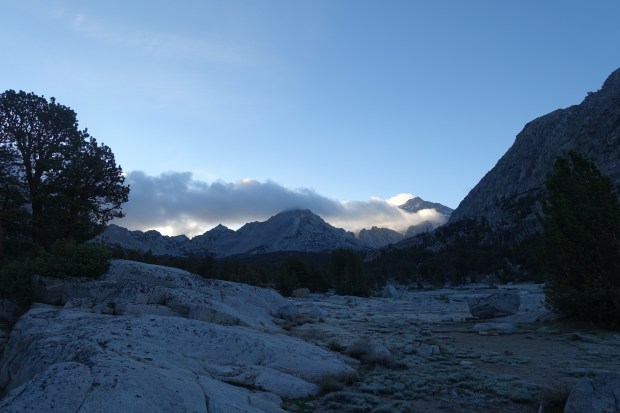
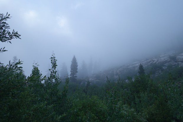
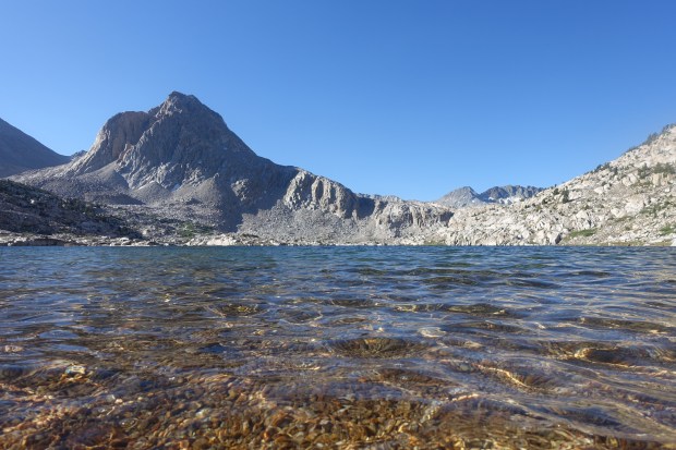
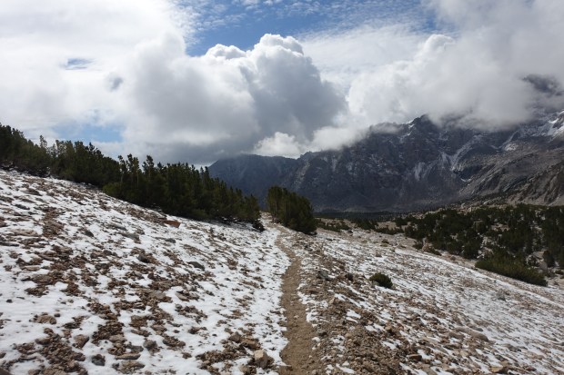
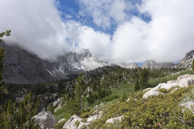
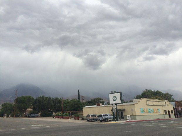
The temperature was very low and all our gear was completely frozen stiff. We had to wait for the sun to climb over the nearby peaks so we could get our gear thawed out. It was quite a sight with the mist floating across nearby Bullfrog Lake.

Given the temperatures, we re-affirmed our decision of yesterday evening to head off the JMT at Kearsarge. We were a little disappointed but knew we had made the right decision and were looking forward to the comforts of a warm, dry room and a comfortable bed.

DSC01535

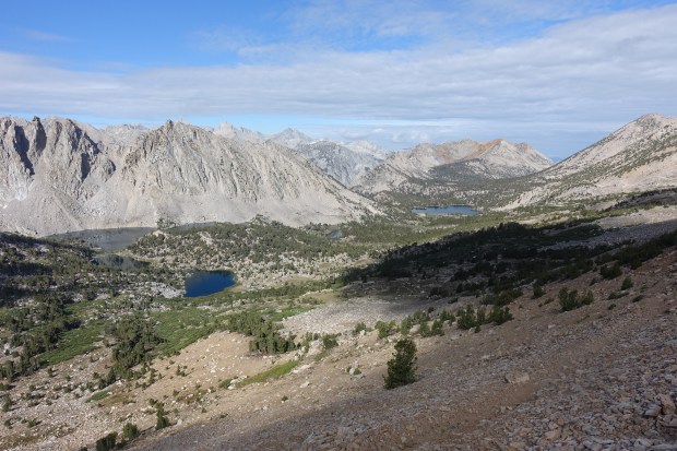
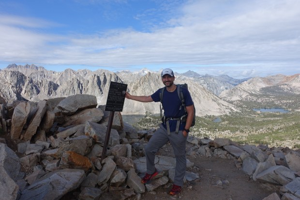
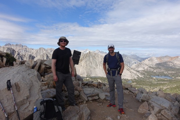
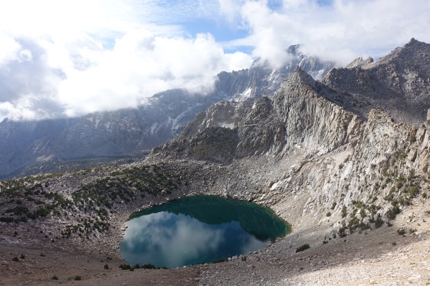
The climb up Kearsarge was fairly easy by JMT standards but, in the High Sierra, even an easier pass is still difficult. We climbed up and ascended higher past two lakes on the right hand side and eventually reached the top of Kearsarge which was our route down into the Onion Valley trailhead and onwards to Independence.

DSC01540

DSC01543

DSC01546

The weather, although cold, showed no signs at this point of the weather of the day before but we were happy with our decision and stood proudly on top of Kearsarge Pass. We were happy with the miles we had hiked and knew that we would at some point in the near future come back and finish this trail off.

DSC01549

DSC01551

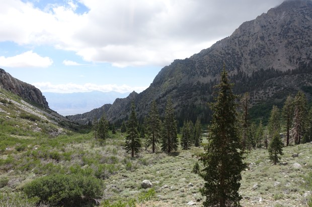
We headed down the other side of Kearsarge and began a long slow descent down to Onion Valley. It was still snowy and icy on the other side of the pass but we soon descended into warmer elevations and eventually hit the Onion Valley trailhead. It was quite the descent and I can imagine it’s a tough climb on the way up.

DSC01552

DSC01555

DSC01559

DSC01560

DSC01561

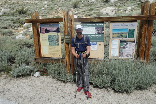
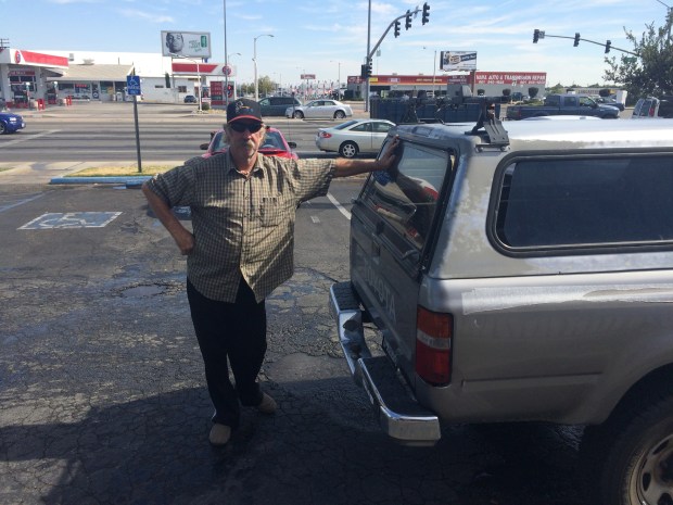
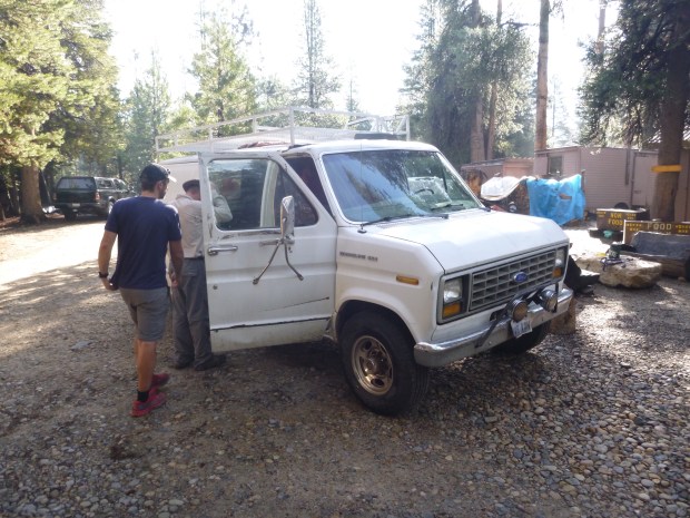
When we got to the trailhead, we were figuring out how we were going to get to Independence 13 miles away and there was no phone reception. Fortunately, a guy called Levi turned up in his pickup truck and was dropping off hikers. I wasted no time in asking if he was headed down to Independence and we hopped in his cab as he drove us down the windy road from the trailhead. We stopped to pick up two hikers on the way as it was a long walk and eventually got dropped off in the centre of Independence and got a room at the Court House Motel.

The weather by this point was closing in and we were glad to be down in the much warmer valley in Independence than up in the peaks above. We headed straight to Subway and didn’t hold back on the calories.

We bumped into a hiker we had seen on the trail. I had rescued his phone for him which I found on the trail so he went and bought us both some beers to say thank you. We looked quite the hiker hobo’s sitting there having a beer outside the gas station from a brown paper bag. He invited us to a party in Lone Pine where he promised us a good time so we politely refused!

IMG_1482

IMG_1483

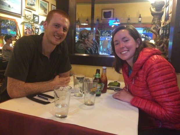
That evening, we headed out to Independence’s finest restaurant which was a French joint called the Still Life Cafe. The food took ages to come out and the service wasn’t that great. We talked to the fellow hikers we had picked up earlier. They had just got engaged so of course we congratulated them. She had walked around 600 miles of the AT but came off the trail as she felt pretty much done by that point.

IMG_1487

Then it was back to the Courthouse Motel. My worn out trail runners and bent trekking poles went straight in the trash and it was then time to hit the sack. Unfortunately, the motel owners were party animals and my room was right next door to their lounge room. Around 1 AM, the noise finally died down and I fell into a deep sleep.


Day 16: The snow hits over Glen Pass

Wood’s Creek to Bullfrog Lake over Glen Pass

Mileage: 13.3 miles (21.4 km), total 185.2 miles (298.1 km)

The day started off very cold and misty and it rained throughout much of the night. We packed up and had breakfast and I think everyone was glad to leave Wood’s Creek behind given the night before.

We climbed up gradually from Wood’s Creek but didn’t get too far. It started to hail quite strongly so we took some shelter under some trees and tried to squeeze out some dry space. We passed a couple of hikers we had been leap frogging with since VVR and one of them told us he wouldn’t be surprised if there was snow ahead.

DSC01451

Continue reading

Day 15: A wet day at Wood’s Creek

Kings River camping area to Wood’s Creek over Pinchot Pass

Mileage: 11.6 miles (18.7 km), total 171.9 miles (276.6 km)

Today was a much easier day over Pinchot Pass which was a far simpler affair than Mather and Muir Passes over the last few days.

The day started with an easy walk from our campsite towards the pass with a gradual climb to begin with. The weather was beautiful in the morning although it was much colder in the air than it had been on previous days. The marmot below didn’t seem to mind the cold weather much or my getting close to him to take a few photos – he must have thought there was a feed coming.

DSC01417

Continue reading

Day 14: Mather was a Mother

Kings River/Mather Pass junction to Kings River camping area over Mather Pass

Mileage: 15.5 miles (24.9 km), total 160.3 miles (258.0 km)

Today was a super hard day over Mather Pass. We packed up nice and early this morning as we knew we would have a tough day and we wanted to take it slow and steady through Deer Meadow and up the first part of the climb through the Golden Staircase.

The day started with a gentle climb up the lower part of the valley. This was a really pleasant relaxing walk ahead of what we knew would get considerably harder as we progressed.

DSC01356

Continue reading

Day 13: Over Muir Pass

Sapphire Lake to Kings River/Mather Pass junction over Muir Pass

Mileage: 14.6 miles (23.5 km), total 144.8 miles (233.0 km)

Today was an awesome day as we climbed our first big pass of the southern end of the JMT. The day began with our campsite at Sapphire Lake which was an awesome spot as the sun came up. The sun reflected off the water and it was a beautiful place to be as we started our day’s hike.

DSC01292

Sapphire Lake

Continue reading

Day 12: A long day to Sapphire Lake

Muir Trail Ranch to Sapphire Lake

Mileage: 16.0 miles (25.7 km), total 130.2 miles (209.5 km)

Today was a big day as we had to get ourselves set up for Muir Pass the following morning. From here on in, the JMT enters real wilderness which is both remote and majestic. The scale of it really stands forefront in your mind as from here to Whitney is so grand and epic in its scale.

We started the day at Muir Trail Ranch and had breakfast as well as grabbing a packed lunch from the Ranch. We met some people over breakfast who were just starting a section hike up to Yosemite so I took plenty of time to talk about the section we had just walked through with them. Breakfast was fantastic with lots of eggs, pancakes, waffles, coffee etc, a thru-hikers dream.

DSC01202

Continue reading

Day 11: At Muir Trail Ranch

Rosemarie Meadow to Muir Trail Ranch

Mileage: 9.5 miles (15.3 km), total 114.2 miles (183.8 km)

Today was a much easier (and safer!) day than yesterday although I was still very sore from top to toe after yesterday’s escapades. A hefty dose of Vitamin I was in order before we started our day’s hike but it was still slow going.

From our campsite at Rosemarie Meadow, it was only a short climb to Seldon Pass and it was more or less all downhill from there to Muir Trail Ranch. The day started off with us passing Marie Lake on our way to the pass. Seldon Pass itself at 10,900 ft was relatively easy – in Sierras terms.

DSC01185

Continue reading

Day 10: How not to ford a creek

Vermillion Valley Resort to Rosemarie Meadow

Mileage: 12.3 miles (19.8 km), total 104.7 miles (168.5 km)

Today was a very tough day for a number of reasons.

We woke up and had breakfast at VVR with one of the PCT hikers who was staying at the resort. His name was Mellow and it was not hard to see how he got his trail name. After breakfast, it was time to hit the trail. Due to the low water levels, we had to get road transport out to where the boat to cross Edison Lake was stored. The boat itself was a small tinnie as the water level was too low for the main boat.

P1000607

Continue reading